Geological Special Maps of Austria Now Available Online Nationwide
With the completion of the GeoFAST project, GeoSphere Austria can now, for the first time, provide geological special maps for all of Austria at a uniform scale of 1:50,000.
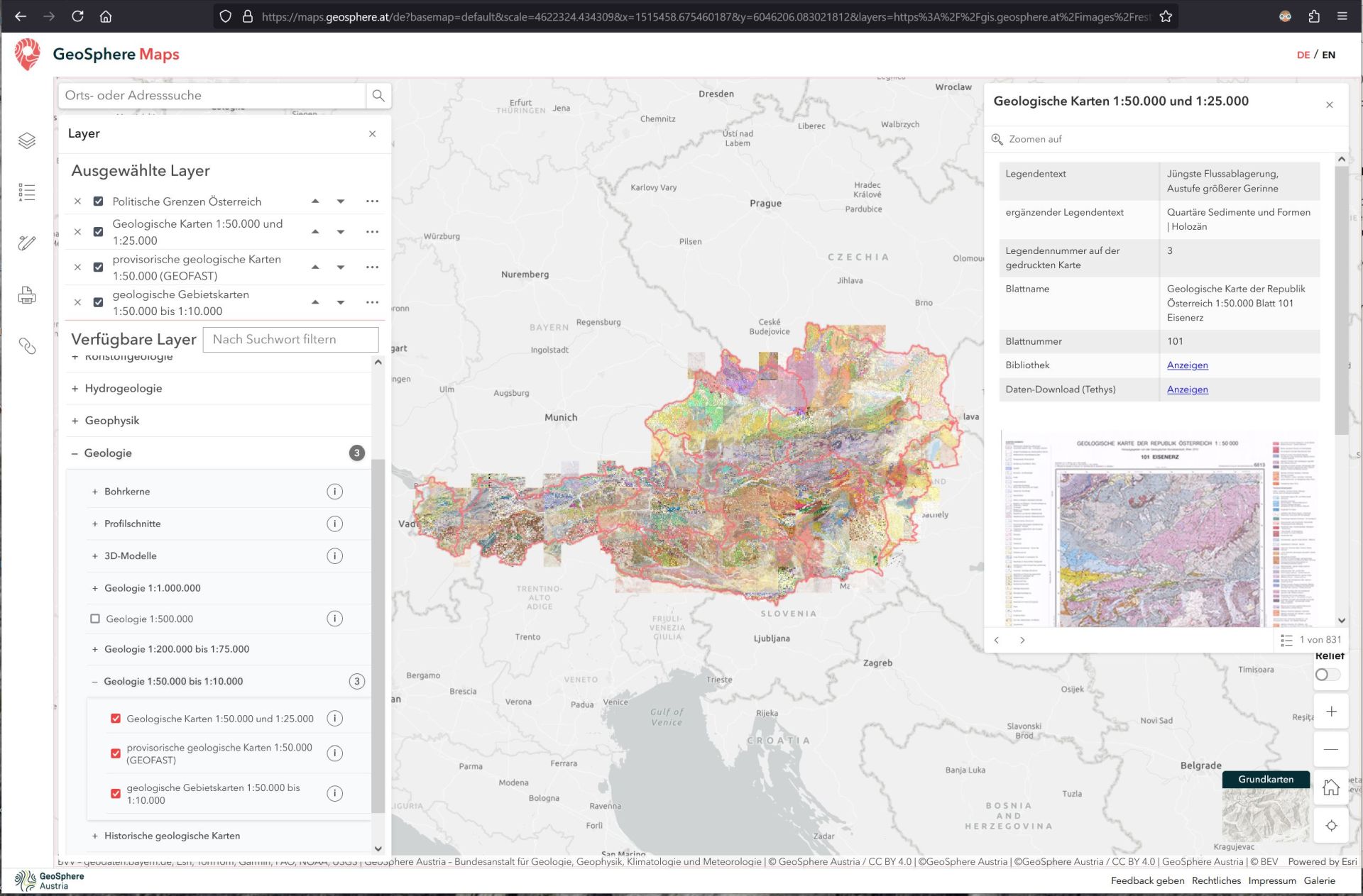
The maps are freely accessible at maps.geosphere.at. The datasets are used, for example, in construction projects, raw material planning, natural hazard assessment, water management, and agriculture and forestry.
As part of the geological survey, GeoSphere Austria records the geological conditions in Austria, including the distribution of rock formations and mountain structures. Rocks, deposits, and structures are examined on-site, rock samples are collected and analyzed, satellite and aerial images are evaluated, and much more. The results serve as a basis for many scientific, economic, and environmental inquiries.
Due to the high effort required for these surveys, detailed special maps were previously available for only about 50 percent of Austria’s territory. However, many regions already had investigations and archive maps.
‘The goal of the GeoFAST project was to create provisional geological maps at a uniform scale of 1:50,000 based on existing archive materials to provide nationwide geological maps in addition to the ongoing scientific mapping,’ explains project manager Esther Hintersberger. ‘The project team, together with regional experts, reviewed and compiled archive materials, adapted them to the modern elevation model, and developed the map legends based on existing surrounding maps. For the first time, an overall picture was created from the many existing parts.’
The geological special maps are freely available online in various formats via the maps.geosphere.at platform (under ‘Layer/Geology/Geology 1:50,000 to 1:10,000’). This platform also contains additional geological information such as borehole data, glacier expansion, mining activities, and more.
This resource serves as an important geological foundation for numerous economic, environmental, and scientific applications. Some examples include: general road and railway construction, particularly tunnel projects, assessing subsurface raw materials, securing against natural hazards such as landslides and earthquakes, locating and protecting groundwater resources, and evaluating soil conditions in agriculture and forestry.
The closing event of the GeoFAST project will take place on March 20, 2025, in Vienna (GeoSphere Austria, Neulinggasse location). The project team and participating organizations will provide an overview of the development and application possibilities of the new datasets (Program closing event).
GeoFAST
For the first time, geological special maps covering all of Austria at a uniform scale are freely accessible on maps.geosphere.at. Source: GeoSphere Austria.
GeoFAST
Thanks to the geological special maps created in the GeoFAST project, GeoSphere Austria can provide the first nationwide dataset of geological special maps for all of Austria at a uniform scale of 1:50,000. Source: GeoSphere Austria.