The wind, that heavenly (and hellish) child
15 June is Global Wind Day. GeoSphere Austria is taking this opportunity to explore both the gentle and the wild sides of this invisible phenomenon, whose spectrum ranges from a pleasant ‘breeze’ to a destructive tornado.
24 June 2021: Just a few kilometres from the Austrian border, in South Moravia, a Category 4 tornado sweeps through five villages with enormous destructive force, causing massive damage. Six people die, 250 are injured. It is a particularly stark example of the power and energy that wind can generate. That same wind can also be quite different. Peaceful and pleasant, helpful and environmentally friendly. ‘The air is like a river with eddies and rocks. There is never a constant flow; there is always turbulence. You turn a corner: suddenly everything is different: first no wind, then a gust. Wind is incredibly inhomogeneous and therefore so complex,”’ says Ingo Meirold-Mautner, Head of the Climate and Renewable Energy Services Department at GeoSphere Austria, describing his field of expertise. Wind arises, so to speak, ‘whenever there is an attempt to establish pressure equilibrium.’ Unless, that is, there is no wind at all. ‘Then there is simply nothing to balance out.’ Wind is heavily influenced by the ground and by buildings: ‘Near the ground, the wind is deflected by obstacles – the air has to divert somewhere, which creates turbulence. But even high up in the open atmosphere, it is never uniform, because pressure conditions are constantly changing with the weather.’ This is one of the reasons, explains Meirold-Mautner, why wind turbines are now 150 metres tall rather than 30. ‘Because the wind is more constant at higher altitudes.’ His department produces expert reports for planned wind farms, but also for other technical installations that are heavily influenced by the wind. Cable cars, for example. Yet there is a fluid transition from ‘gentle’ to ‘wild’ wind. Wind turbines need it to generate electricity. However, if it blows too strongly – from around 25 metres per second (about 90 km/h) – modern turbines turn their rotor blades out of the wind and reduce their output until, during a storm, the rotor turns only slowly or comes to a complete standstill – so as not to overload the system.
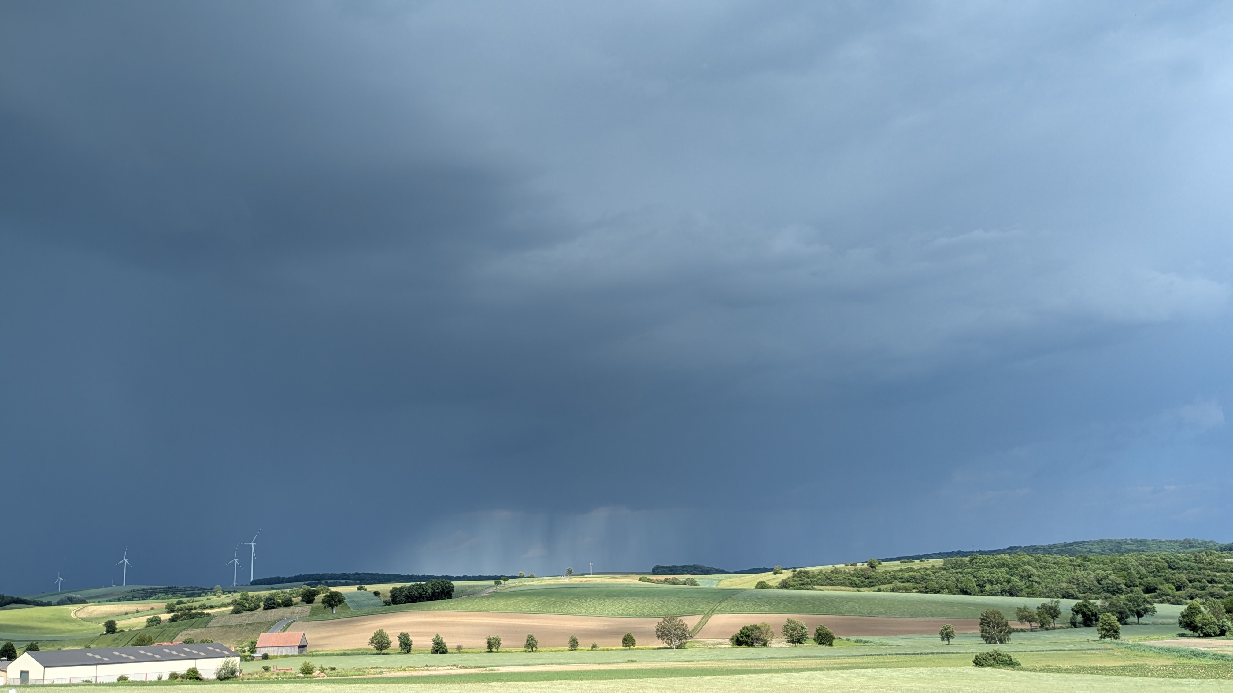
Wetzleinsdorf_30-05-23026.jpg
A thunderstorm over the Kreuzstetten wind farm (Weinviertel, Lower Austria) on 30 May 2026. © GeoSphere Austria/Janda.
Back to 24 June 2021. Most storms associated with thunderstorms involve downdrafts. ‘On the one hand, some of the precipitation evaporates, causing the cooled air to fall like a sack that has been emptied; on the other hand, the upper-level wind is also drawn down and reaches the Earth’s surface in the form of gusts,’ explains climate researcher Georg Pistotnik from GeoSphere Austria. ‘In contrast to downdrafts are the much rarer tornadoes. These are the most extreme updrafts from thunderclouds, with the inflowing and rising air rotating around its axis of flow like a perfectly thrown American football,’ describes Pistotnik. Factors conducive to the formation of a tornado include differing winds at various altitudes, a strong convergence of winds near the ground, particularly humid air, and a deviating path of a thunderstorm. Pistotnik: ‘Tornadoes can produce the strongest known winds in our atmosphere.’ In Austria, an average of four tornadoes occur each year, most of them in relatively flat areas stretching from the Waldviertel and Weinviertel regions through the Vienna Basin to southern Styria.
The most powerful storms are often a combination of the phenomena mentioned. Particularly extreme examples of thunderstorm lines associated with the cold fronts of winter storm systems include Storm ‘Kyrill’ in January 2007 and Storm ‘Emma’ in March 2008. ‘A thunderstorm line that moved into hot, dry air driven by the Föhn wind was responsible for the particularly extreme and, for many, surprising thunderstorm on 18 August 2022, which stretched from Corsica via northern Italy and Austria to the Czech Republic and claimed five lives and left dozens injured in this country alone,’ emphasises Pistotnik. The highest wind gust ever recorded in Austria and now considered accurate was 220 km/h on the Feuerkogel (Upper Austria) during storm ‘Lothar’ on 26 December 1999. The highest recorded wind gust in a populated area is 163 km/h at Vienna International Airport in Schwechat (Lower Austria) during storm ‘Emma’ on 1 March 2008. The strongest known tornado in Austrian history struck Wiener Neustadt on 10 July 1916, claiming 35 lives and leaving more than 300 people injured.
Whether storms are becoming more frequent and severe as a result of man-made climate change has not yet been conclusively established, says climate researcher Georg Pistotnik: ‘Because the governing mechanisms sometimes develop in opposite directions. For instance, the temperature contrast between low and high latitudes – which determines the strength of storm systems – is decreasing due to the particularly pronounced warming of the polar regions; conversely, in a warmer atmosphere, low-pressure systems can utilise more ‘latent’ energy in the form of water vapour condensing into clouds.’ As long as it remains unclear which of these two factors will dominate, no systematic change in the frequency and intensity of winter storm systems is to be expected, Pistotnik concludes. “Thunderstorms, on the other hand, are likely to become more severe, because here too the increased conversion of water vapour to liquid water and back is the dominant process, which in a warmer atmosphere further intensifies both the updrafts and the downdrafts of thunderclouds.”
The climate researcher offers a cautious outlook for the summer: ‘Over the coming week, a veritable mass of hot air will spread across western and central Europe, with a strong jet stream flowing around its northern edge.’ This opens up a window of opportunity for an increased likelihood of major, widespread thunderstorms. ‘These tend to occur in such situations – and not infrequently in whole series lasting several days or even a week or two,’ adds Pistotnik. However, it is still too early for specific forecasts.
Translated with DeepL.com (free version)